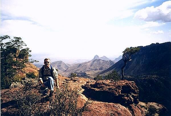
On Lost Mine Peak
| Big Bend Hiking - March 23-31, 1999 |
|---|
| | | Home Page | | |
|---|
Introduction

On Lost Mine Peak
Meeting in El Paso before traveling on to Fort Davis State Park we began with a welcome dinner and orientation, meeting staff and traveling companions. As I'd hoped there was a wider range of ages, late 30's to mid 80's, than the more sedentary Smithsonian tours I'd taken before. It was nice not to be the baby for a change. Three staff, a naturalist, geologist and Smithsonian representative who handled logistics, ten couples and 13 traveling alone made up the company.
| | | Home Page | | |
|---|
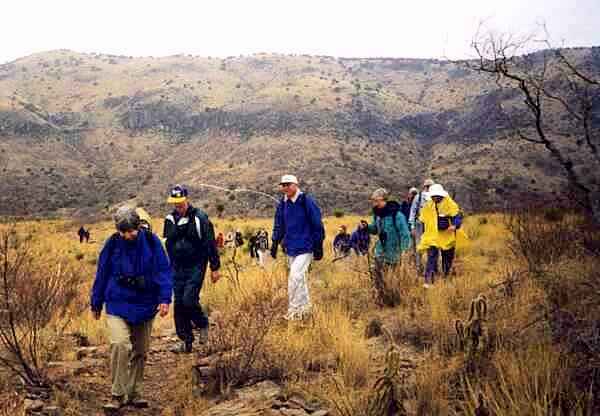
Off The Ridge to Old Fort Davis
After riding several hours north from El Paso into the Chisos Mountains we were dropped off onto a ridge overlooking Old Fort Davis. In spite of the cool weather and a light mist we were in good spirits. This is what we came to do.
| | | Home Page | | |
|---|
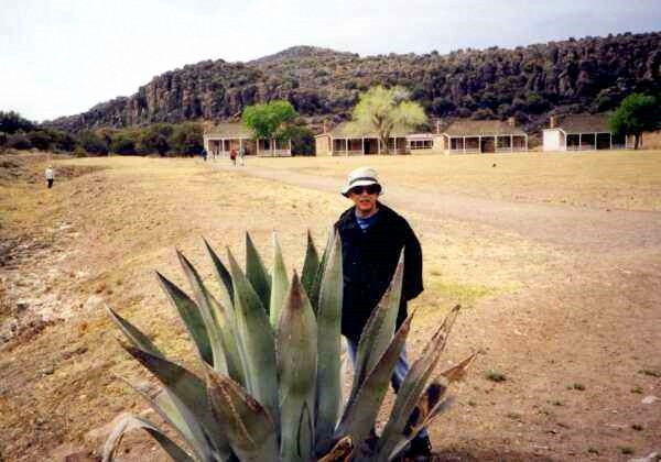
At Old Fort Davis
No optical allusion, I'm standing directly behind this Aloe and it's still a baby. Seeing a row of 8-foot tall identical plants bordering the El Paso Art Museum I thought they were bronzes. The "leaves" are incredibly stiff, engorged with water absorbed over the winter season.
Restored officers quarters can be seen in the background. Enlisted barracks and the Quartermasters storehouse have also been carefully restored. Reenactors add to the atmosphere. Fort Davis, built before the Civil War, was abandoned during that conflict but reoccupied afterward, providing protection for settlers. Fort Davis was home to Buffalo Soldiers, black cavalrymen of the U.S. Army.
| | | Home Page | | |
|---|
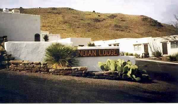
Indian Lodge - Davis Mountains Texas State Park
We stayed at Indian Lodge for two nights. The Lodge, in the center of Davis Mountain Texas State Park, was built in the 30's by the CCC. Surrounding a central courtyard garden, Spanish style, the thick stucco walls retained the suns heat releasing it at night keeping us comfortable warm in the unseasonably warm and wet Texas Springtime. Behind the lodge a flock of wild turkeys gathered each evening.
| | | Home Page | | |
|---|
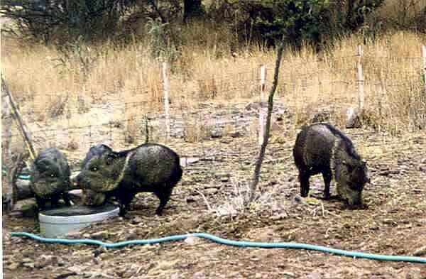
Javalinas - Chisos Mountains State Park
Early morning near Indian Lodge we encountered a herd of peccary, called Javalina locally, pig size (distant) relatives of the horse family. While they look a bit like warthogs they have solid, not forked, hoofs. They have poor eyesight and poorer hearing, spending the day in small family groups rooting for food.
They're easy to sneak up on ... don't go there! Not aggressive by nature, startled, their tusks can do a lot of damage and the entire group will attack to defend an individual. They smell like ripe skunk so if you pay attention you're unlikely to stumble onto one
| | | Home Page | | |
|---|
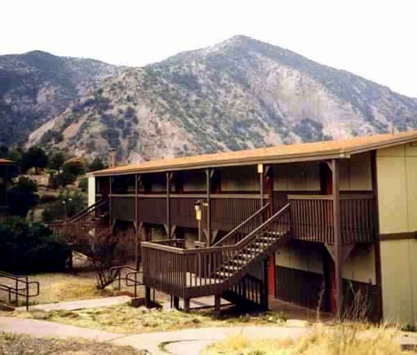
Chisos Mountains Lodge
Moving on for four nights at Big Bend National Park, more bus time, we really got into mountains or, more accurately, the remains of massive volcanic eruptions. The peaks of the ring formed by the Chisos Mountains, whose collapsed caldera contains park headquarters and the Chisos Mountains Lodge, rise to 6500 feet.
No phones, radios or televisions are in the rooms to distract from the experience.
| | | Home Page | | |
|---|
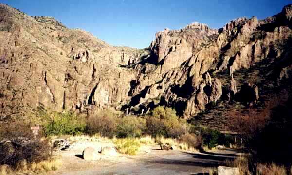
Big Bend National Park - The Basin
As the softer rock eroded the fin-like rock structures of old lava have been exposed. This volcano didn't explode, the magma oozed up through the earth solidifying underground.
| | | Home Page | | |
|---|
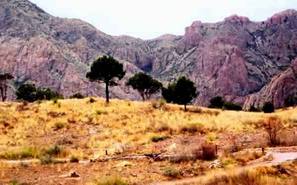
View From The Veranda - Chisos Mountain Lodge
This view is from the veranda of my room. The paved trail in the foreground begins a loop within the basin.
| | | Home Page | | |
|---|

Welcome to the Window Trail
Leaving the lodge for an early morning solo hike I turned a corner on the trail to find this sign. Below it was another, listing things to do when you encounter a mountain lion. Rule 1, Show no fear Rule 2, Appear large. I was also instructed "Do not turn and run or crouch down. Look big, throw rocks and sticks and yell." Figuring it was easier to appear large in the center of a group I returned to share breakfast with the rest of our party rather than read the rest of the rules.
| | | Home Page | | |
|---|
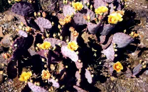
The Desert Blooms
An upside of the damp weather was enjoying the desert in bloom, flowers everywhere like this Prickly Pear cactus.
| | | Home Page | | |
|---|
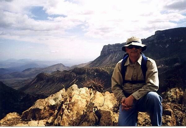
Along The Lost Mine Trail
We took a breather on the way to Lost Mine Peak. Here's a view from the Juniper Canyon overlook. A vintage National Park Service guide to the Lost Mine Trail, and the park in general, is available.
| | | Home Page | | |
|---|
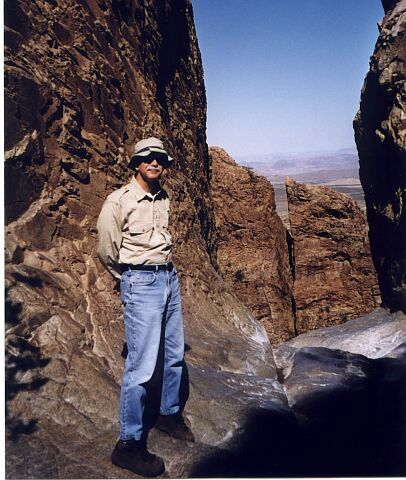
The Window
The Window Trail took us through the heart of the Basin. Descending from the Lodge we followed the course of a stream to "The Window."
| | | Home Page | | |
|---|
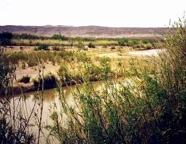
The Rio Grande at Cottonwood Campground
Traveling through Southwest Texas we touched the Rio Grande many times. The river wears many faces. In El Paso it runs in places in a concrete trough. Santa Elena Canyon contains a white water rafters dream. At most places though the Rio Grande is a gentle stream, not what I'd imagined for the border between countries.
| | | Home Page | | |
|---|
On The Trail
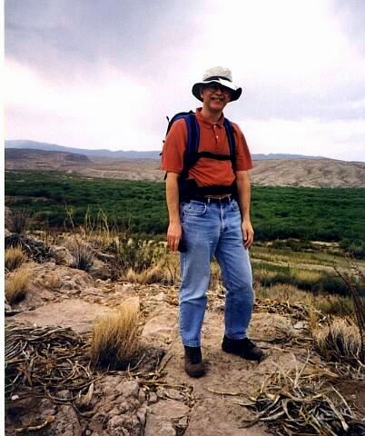
The green belt in the background follows the Rio Grande in Mexico. The threatening sky in the background brought heavy rain.
This hike was canceled. Soon after leaving the bus we climbed to the top of this ridge and, from horizon to horizon, saw a massive dust cloud driven by rolling black clouds. Hundreds of birds flew ahead of the storm. We hightailed it back to the bus just beating the rain, sleet and hail. Several parties were caught in the storm and looked terrible as they straggled back to the trailhead.
| | | Home Page | | |
|---|
Santa Elena Canyon
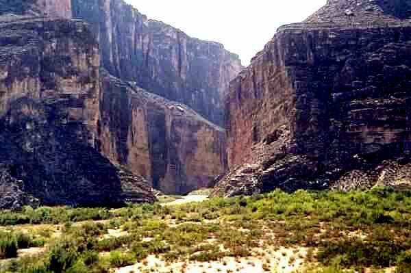
A fellow at work has a calendar with a black and white Ansel Adams-like picture of Santa Elena Canyon from this same viewpoint. The photo was taken in the 40's and it was fun to see the same features, even the larger boulders, in the same places, 60 years a blink in geologic time. We crossed a river, Terlingua Creek, that runs into the canyon twice onto our way in. The water ran deep and we formed a human chain to get across. The Rio Grande is visible in the background and flows through the canyon.
| | | Home Page | | |
|---|
Inside Santa Elena canyon
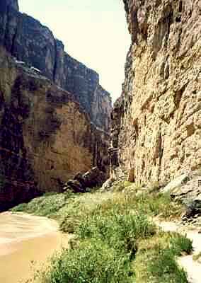
The steep canyon walls concentrated the heat of the sun trapping the moisture as it evaporated. The feeling was tropical with cane growing along the banks.
| | | Home Page | | |
|---|
Santa Elena Canyon - The Border
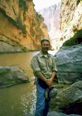
Mexico is on the left, the U.S. on the right. This spot is as far up the canyon as you can walk.
| | | Home Page | | |
|---|